Tepango Valley Archaeological Survey
The Tepango Valley Archaeological Survey (TVAS), funded by the National Science Foundation (BCS-0712056) the Foundation for the Advancement of Mesoamerican Studies, Inc. (# 07049) and the University of Kentucky, was undertaken to unravel interactions among peer polities in the Classic Tuxtla Mountains, southern Veracruz, Mexico. Research since the 1980’s has demonstrated that Matacapan was founded during the Early Classic (A.D. 300-450) by a group displaying foreign Teotihuacan symbols and those symbols and associated rituals were found over much of the upper Catemaco Valley by the Middle Classic (A.D. 450-650).
In the neighboring Tepango Valley to the west and along the northern shores of Lake Catemaco to the east, however, the contemporaneous centers of Totocapan and Teotepec show more localized adaptations common to the Gulf Coast. I surveyed 120 square kilometers at Totocapan and along the Tepango Valley in order to unravel the nature of interaction among these peer polities. I found that political, economic, symbolic, and ritual interactions followed disjoint but overlapping trajectories across the landscape. Interactions between Totocapan and Matacapan, in particular, involved cooperative economic exchanges (identified through neutron activation analysis [NAA]), but neither center adopted the symbols, architectural layouts, or rituals that characterized the opposing regime. This research demonstrates the need for multiscalar perspectives that examine both the interrelationships and disjunctures among different social networks across space and time.
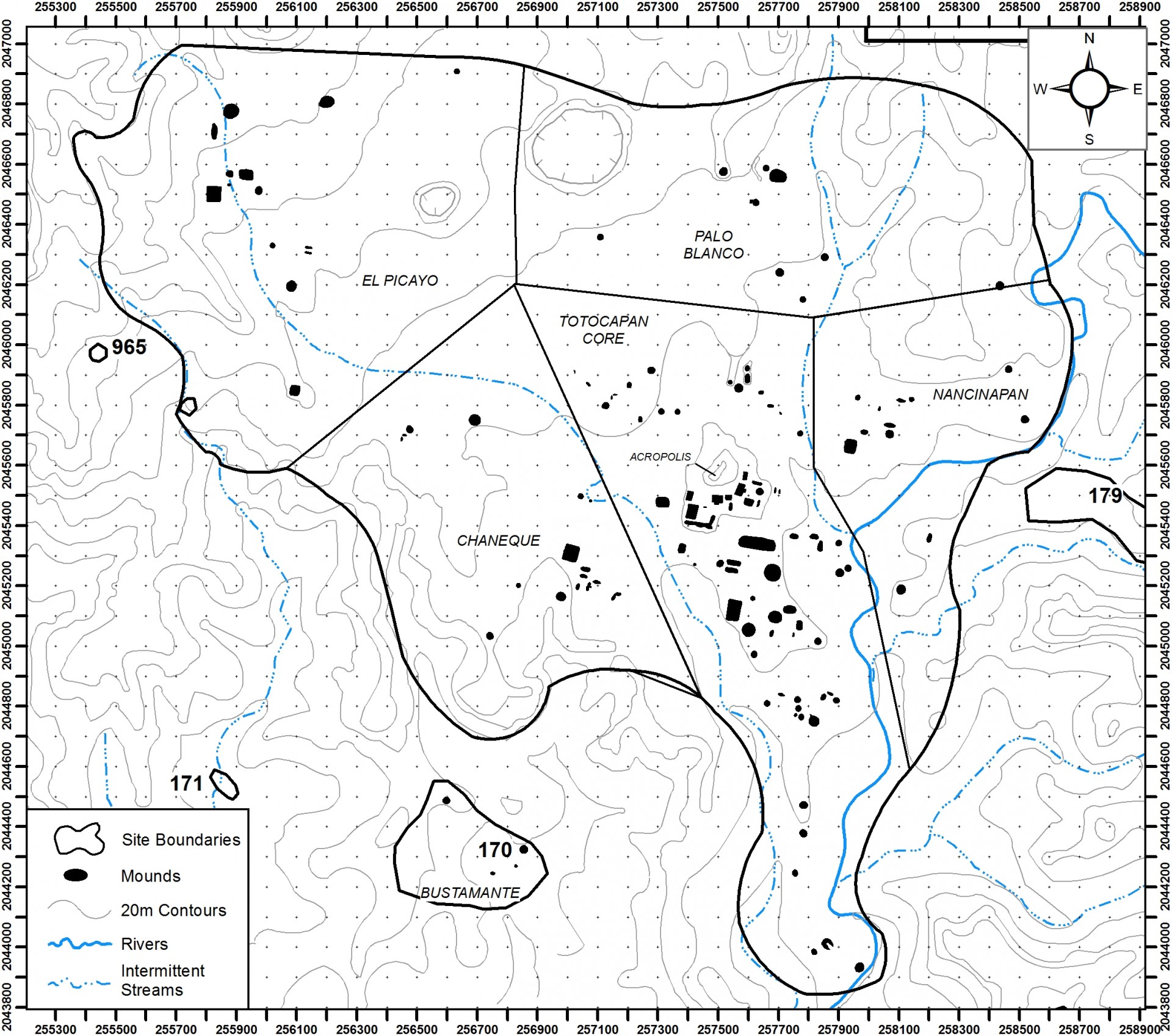
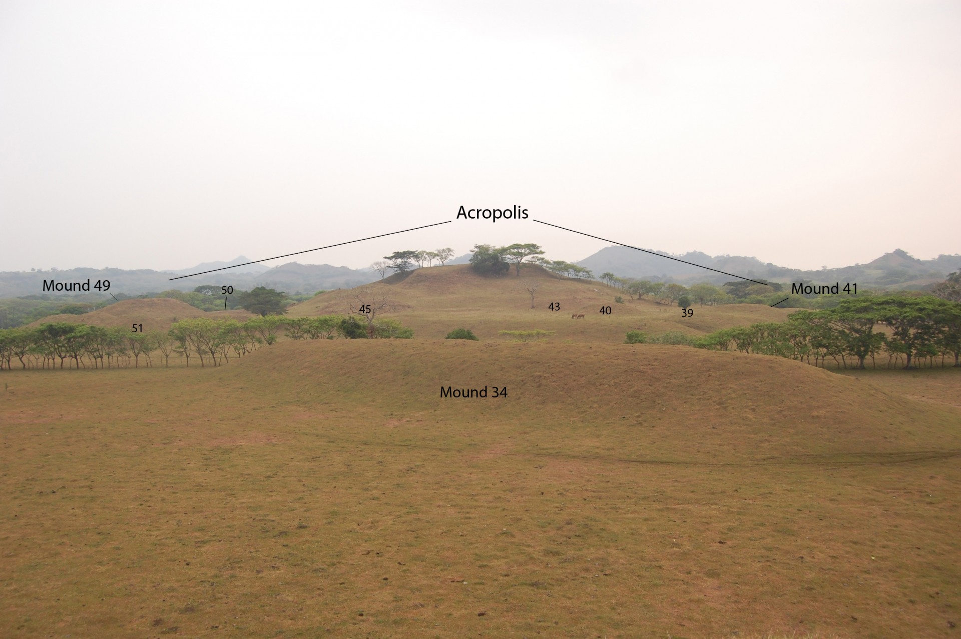
Totocapan is perhaps the largest, or at least most architecturally complex, site in the Classic Tuxtla Mountains. It covers almost 6 square kilometers and possess over 125 earthen constructions that would have served residential, administrative, and ritual functions. Even more impressive than the individual mound constructions are the massive landscape transformations represented by terracing in certain locations of the site. The largest construction at the site and probably the entire region, the Acropolis, was a natural hill transformed into a massive palace complex that undoubtedly housed the site’s leaders. Massive amounts of earth were moved by hand to create terrace platforms on which individual buildings were constructed. The footprint of the Acropolis conforms to the architectural orientation of the site at large. The terrace platforms extend from the upper parts of the Acropolis until at least 400 m to the south.